LiDAR Data Programing
ALWAYS A POINT TO OUR MODELLING
LiDAR Data Processing Services
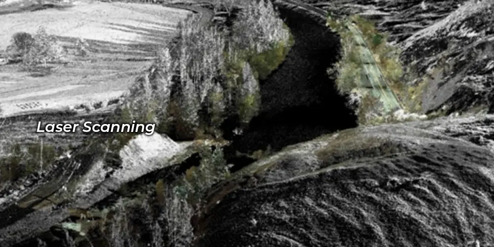
At Microskill Technologies, we take pride in being a leading LiDAR mapping company, offering top-tier LiDAR Data Processing Services tailored to various industries. LiDAR (Light Detection And Ranging) represents a cutting-edge technology in topographical data collection, providing high-speed, high-density, and accurate data. Our LiDAR data processing services are conducted with precision, whether in broad daylight or at night, under clear conditions.
LiDAR mapping services have emerged as a popular remote sensing technique for pinpointing the exact location of objects on the earth’s surface. As a premier LiDAR company, we facilitate on-field data capture of the target and offer comprehensive LiDAR data processing services, including elevation data analysis, making it applicable across various sectors.
Microskill Technologies specializes in both airborne and terrestrial/mobile LiDAR processing types, ensuring versatility and effectiveness in addressing diverse client needs. We take immense pride in the quality of work we deliver through our LiDAR mapping services, consistently striving to exceed client expectations and deliver actionable insights for informed decision-making.
Our LiDAR Data Processing and Mapping Services
Our business provides top-notch LiDAR data processing and mapping services to meet the needs of numerous sectors due to the rising need for precise and high-resolution mapping data.
Airborne LiDAR Data Processing
At Microskill Technologies, we harness the power of airborne LiDAR technology to deliver precise and cost-effective terrain measurements, sophisticated categorization, vegetation heights, DTM (Digital Terrain Model), DSM (Digital Surface Model), and building data. With our expertise in LiDAR data processing, we enable clients to access accurate and detailed information about their surroundings, facilitating informed decision-making and efficient project management.
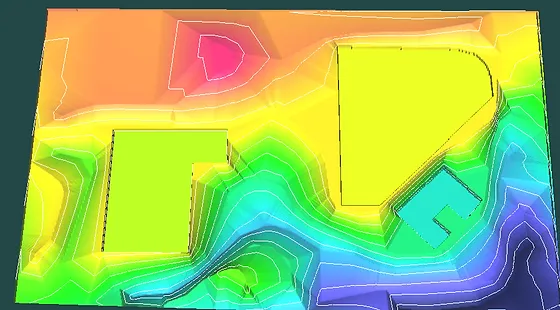
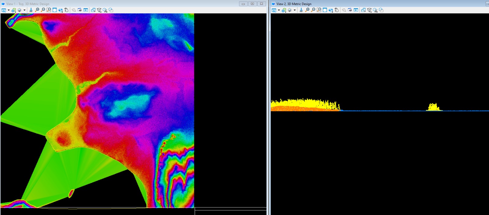
Bare Earth Extraction (DEM/DTM)
When analyzing LiDAR data for terrain identification purposes, bare earth extraction is paramount. At Microskill Technologies, we understand the critical importance of this process and offer exceptionally accurate data tailored to the specific needs of our clients. Through our advanced LiDAR data processing capabilities, we ensure precise bare earth extraction, providing clients with actionable insights for their projects.
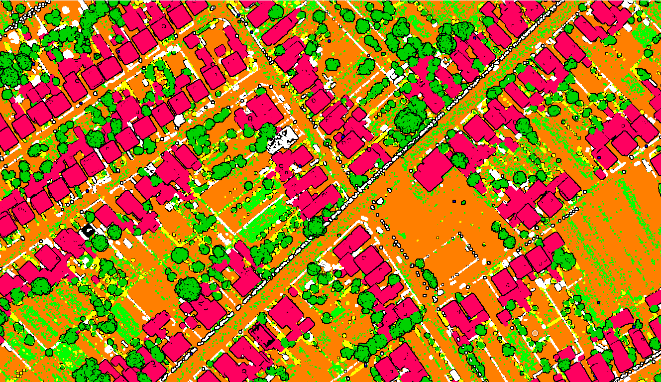
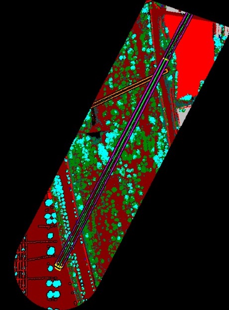
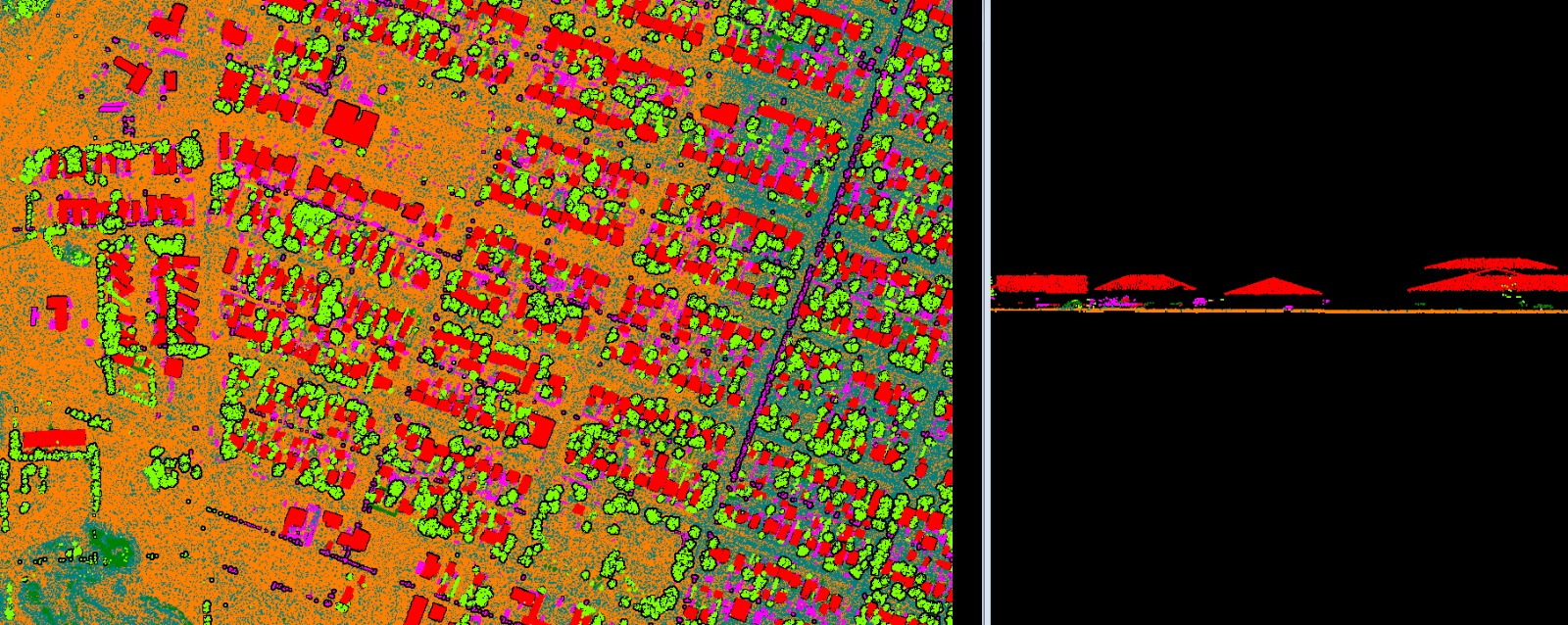
Advance Classification
At Microskill Technologies, our approach to achieving maximum overall classification accuracy involves dividing multi-spectral LiDAR intensity data into four distinct classes: structures (encompassing buildings and trees), roads, bridges, and grass. Through meticulous data processing techniques and advanced algorithms, we ensure precise classification, empowering our clients with actionable insights and enhancing the effectiveness of their projects.
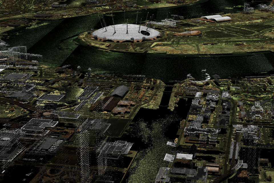
Image Overlay and Point Cloud Colorization
At Microskill Technologies, we go beyond simple coloring techniques to deliver more compelling and visually striking results for our clients. Through the utilization of advanced image overlay and point cloud colorization techniques, we elevate the visualization of terrain data, transforming it into vivid and immersive representations. Our expertise in these methods enables us to create captivating visualizations that enhance understanding and decision-making for various projects and applications
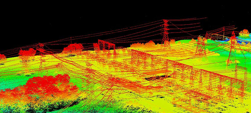
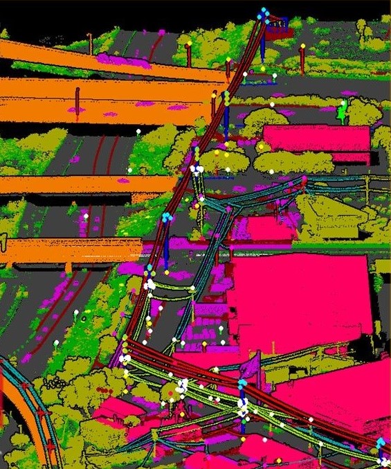
Powerline Classification & Vectorization
Powerline corridor mapping is extensively utilized in government projects and offers solutions for the electricity industry, addressing the needs of both transmission and distribution networks. At Microskill Technologies, we specialize in powerline corridor mapping, providing comprehensive solutions for the classification and vectorization of power lines. Leveraging advanced techniques and technologies, we assist clients in efficiently managing and optimizing power line infrastructure, ensuring reliable and effective electricity transmission and distribution.
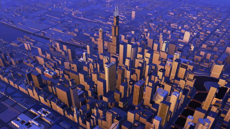
3D City or Building Modeling
Development demands customization, and at Microskill Technologies, we understand the importance of tailored solutions. 3D city models are increasingly vital in the industry for visualization purposes, and we ensure our clients stay ahead by providing cutting-edge 3D city and building modeling services. Keeping abreast of the latest industry standards, our team at Microskill Technologies delivers customized 3D models that meet the specific needs and requirements of each project, enabling clients to visualize their concepts with precision and clarity.s leo
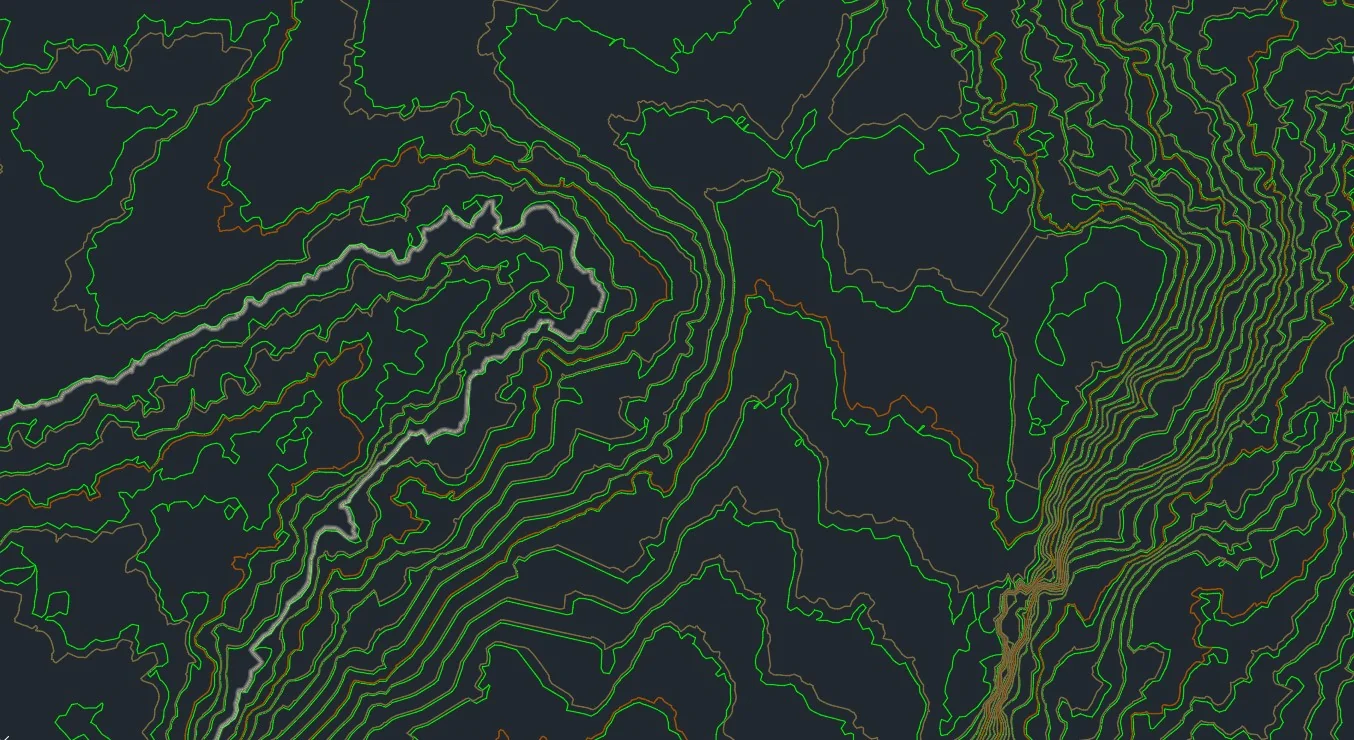
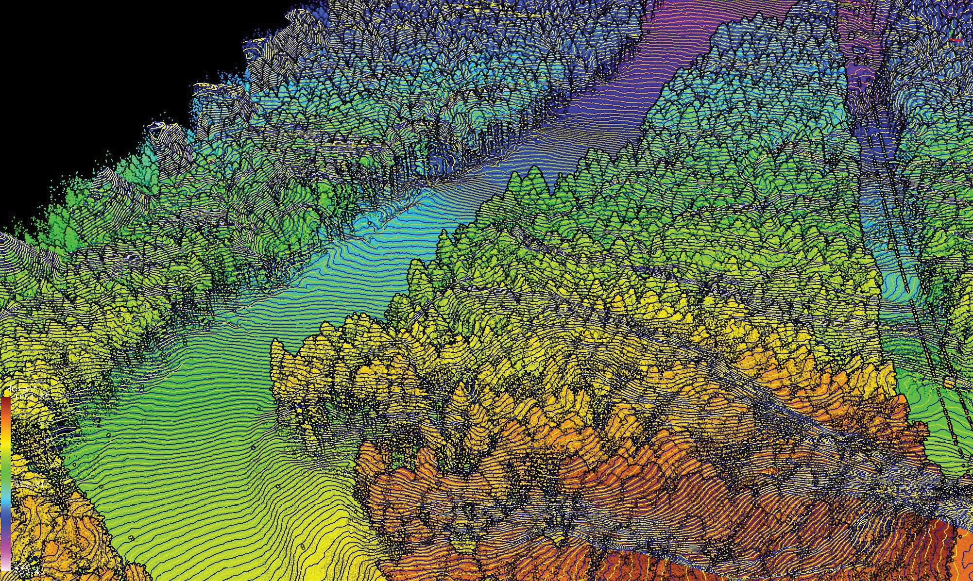
Breakline & Contour Generation
At Microskill Technologies, we specialize in providing the most precise and reliable representation of topography mapping through LiDAR data. Breaklines play a crucial role in regulating the smoothness and continuity of surface behavior in our mapping processes. Leveraging advanced LiDAR technology and meticulous data processing techniques, we ensure accurate topographic mapping that meets the highest standards of quality and reliability. With Microskill Technologies, clients can trust in the integrity and precision of their topographic data for a wide range of applications
Orthophoto Generation
At Microskill Technologies, we have a proven track record of successfully completing projects that demand orthophoto production and color balancing. Our expertise in this area, coupled with our commitment to leveraging the latest tools and technology, ensures that we deliver results with precision and accuracy every time. Clients can trust Microskill Technologies to provide orthophotos that are meticulously color balanced, meeting the highest standards of quality and reliability in all our deliveries.

3D-Feature Vectorization
Research in feature extraction has intensified, particularly in the field of 3D vectorization. At Microskill Technologies, we are at the forefront of this advancement, leveraging cutting-edge technologies and methodologies to extract features with precision and accuracy. Through our expertise, certain geometries such as lines, curves, and polygons are seamlessly converted from point clouds, raster data, or other formats into vector data types. Our commitment to innovation and excellence ensures that we deliver high-quality results that meet the evolving needs of our clients.